Possible project ideas

Note: this is only a small list of ideas for projects. If you’d like to propose your own, please get in touch. Importantly, I value excitement and curiosity over any pre-existing quantitative skills you may have, so don’t shy away from getting in touch if you don’t have a modelling or coding background.

Urban tree risk mapping for the City of Melbourne (Honours or Masters project)

Melbourne's urban forest

Melbourne's urban forest


The City of Melbourne are interested in understanding pest and weed threats that hamper their commitment to their Urban Forest strategy. Our aim is to produce a web app to visualise pest threats in the City of Melbourne as well as priority areas for management. This would be an extension of their existing Urban Forest Map.

The City of Melbourne’s urban tree inventory will be overlaid with pest and weed survey data, which will be fed into models to forecast future threat scenarios. The student will be in charge of building these pest spread and tree distributional models by extending models I’ve already published. All of these data and model outputs will be used to develop a web app in Shiny or similar for City of Melbourne residents to examine pest threats near them and inform municipal planning for urban plant health. We intend to make the web app available through the City of Melbourne’s webpage and through an open source GitHub repository (or equivalent).

Developing biosecurity best practices for the edible insect industry (PhD project)

black soldier fly on a leaf

Black soldier fly, proposed as means to increase the value of food waste, Courtesy of AgriFutures Australia


Edible insects have been proposed as a solution to the increased need for protein in response to human population growth. The insect industry has the potential to become a major rural industry in Australia and provide a more sustainable alternative to traditional farming practices. However, the import and rearing of non-native insects for food and feed, like the import of any crop or livestock for agricultural purposes, is at risk of becoming a major pathway for the introduction of devastating invasive species into Australia’s native ecosystems. To ensure this industry can deliver what it promises for sustainability while averting detrimental impacts on native biodiversity, we must understand the biosecurity risks of the insect industry and how to mitigate them. I am interested in developing a set of models of invasion risk of key potential agricultural import species such as the black soldier fly, Hermetia illucens to understand their economic and ecological consequences. It will be key to understand the likelihood of establishment success outside rearing facilities, the extent and location of potential suitable habitat, and the locations of key native competitors in Australia. In doing so, we can begin outlining the highest-risk incursion areas to ensure that rearing facilities are planned for lower-risk areas.

Cooperative management of invasive species spread (Masters or Honours project)

Mountain Pine Beetle

Mountain Pine Beetle

Mountain Pine Beetle Range Expansion

Mountain Pine Beetle range expansion (courtesy of NRCan)


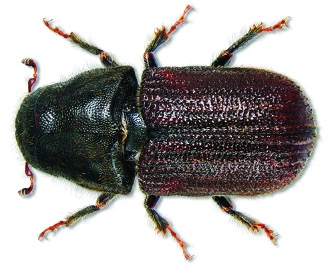
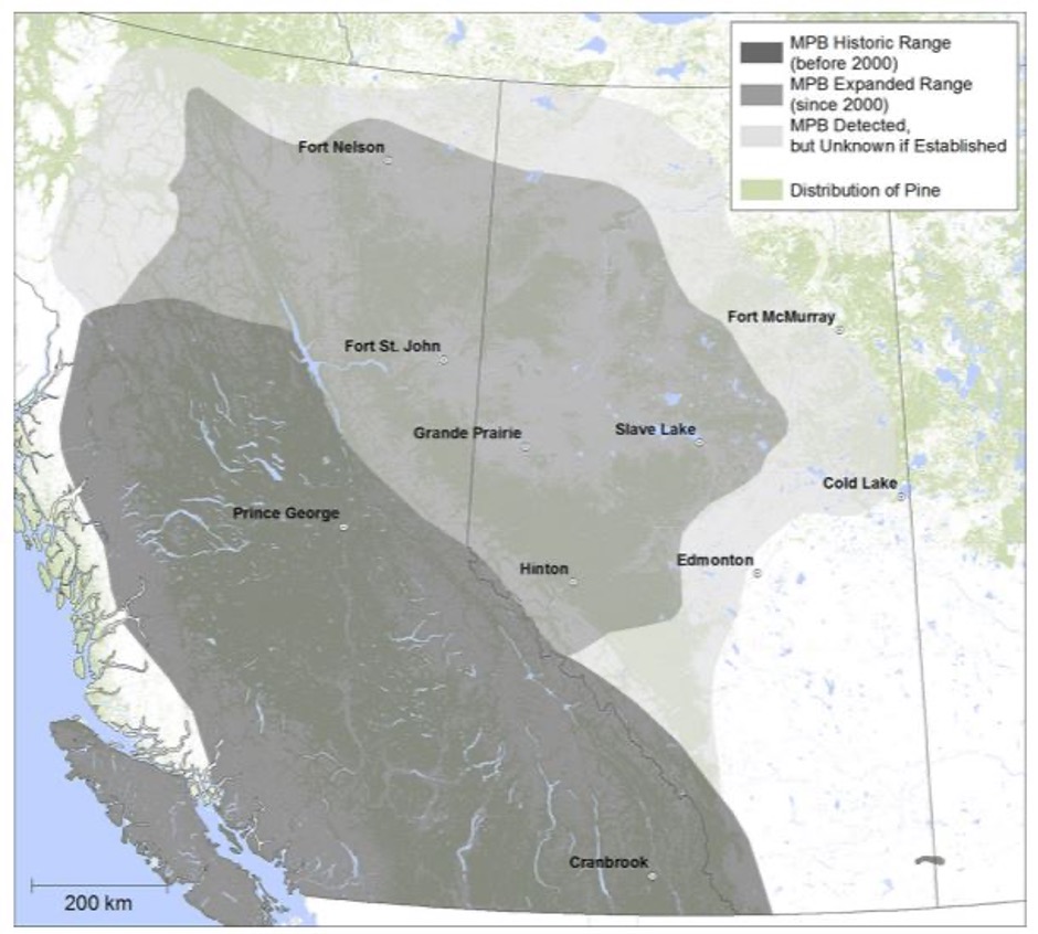
In Canada, an insect called the Mountain Pine Beetle is moving Eastward under climate change. This native species has started to behave more like an invader thanks to warming temperatures and is threatening a much larger swath of forest than it ever did before. In response to this threat, two Canadian Provinces have decided to work together to control its spread. Currently, the Province of Sakatchewan pays its neighbour, the province of Alberta, part of their tree surveillance and removal budget, in order to avoid the beetle spreading into their province. Alongside Drs. Denys Yemshanov, Devin Goodsman and Chris MacQuarrie at the Natural Resources Canada - Canadian Forest Service and Dr. Bob Haight at the USDA Forest Service, we are building optimisation models that borrow from Game Theory to determine the optimal arrangement of tree removal effort and the optimal transfer of funds from one province to another that lead to a win-win for both provinces.

With the Center for Excellence in Biosecurity Risk Analysis at the University of Melbourne, there is the potential to expand this framework to examine insurance payments undertaken by companies that move potentially infested items within Australia to allow win-wins for business and native biodiversity.

Where will trees move under climate change and how should we protect them to facilitate successful movement? (PhD project)

Climate Projections for Australia

Climate projections for Australia from Vanderwal et al. (2013) Nature Reports Climate Change

Australian Plant Range Shift Projections

Australian plant range shift projections from Butt, Pollock & MacAlpine (2013) Ecology and Evolution

Recent projections show major shifts in the habitat suitability for trees across North America due to climate change. However, taken as is, they assume trees can immediately respond to climate change. I’m currently working to combine these models to quantify our best understanding tree range shift predictions, their uncertainty, and what they mean for management. These shifting ranges could mean that new areas will be preferred sites for monitoring or management interventions compared to current priorities. Interestingly, a Northward shift in the ranges of Canada’s trees could allow for cheaper land to become more valuable from a conservation perspective. The Canadian arm of the project is already funded through a Canadian National Science and Engineering Research Council’s Alliance granting scheme with partners at Environment and Climate Change Canada and the Nature Conservancy of Canada, but the aim would be to expand it to the Australian context.

This project would combine several highly uncertain tree and climate datasets with tree dispersal models built from the recently created BIOShifts database to estimate future tree distributions in a way that accounts for seed dispersal capacity. These models would use my existing invasive species dispersal modelling framework as a basis. The creation of these more complex models with uncertainty can help answer the question of whether conservation actions targeting trees should be changed to account for the predicted shift in their distributions. These include interventions like protected area establishment, monitoring activities, and active tree planting.

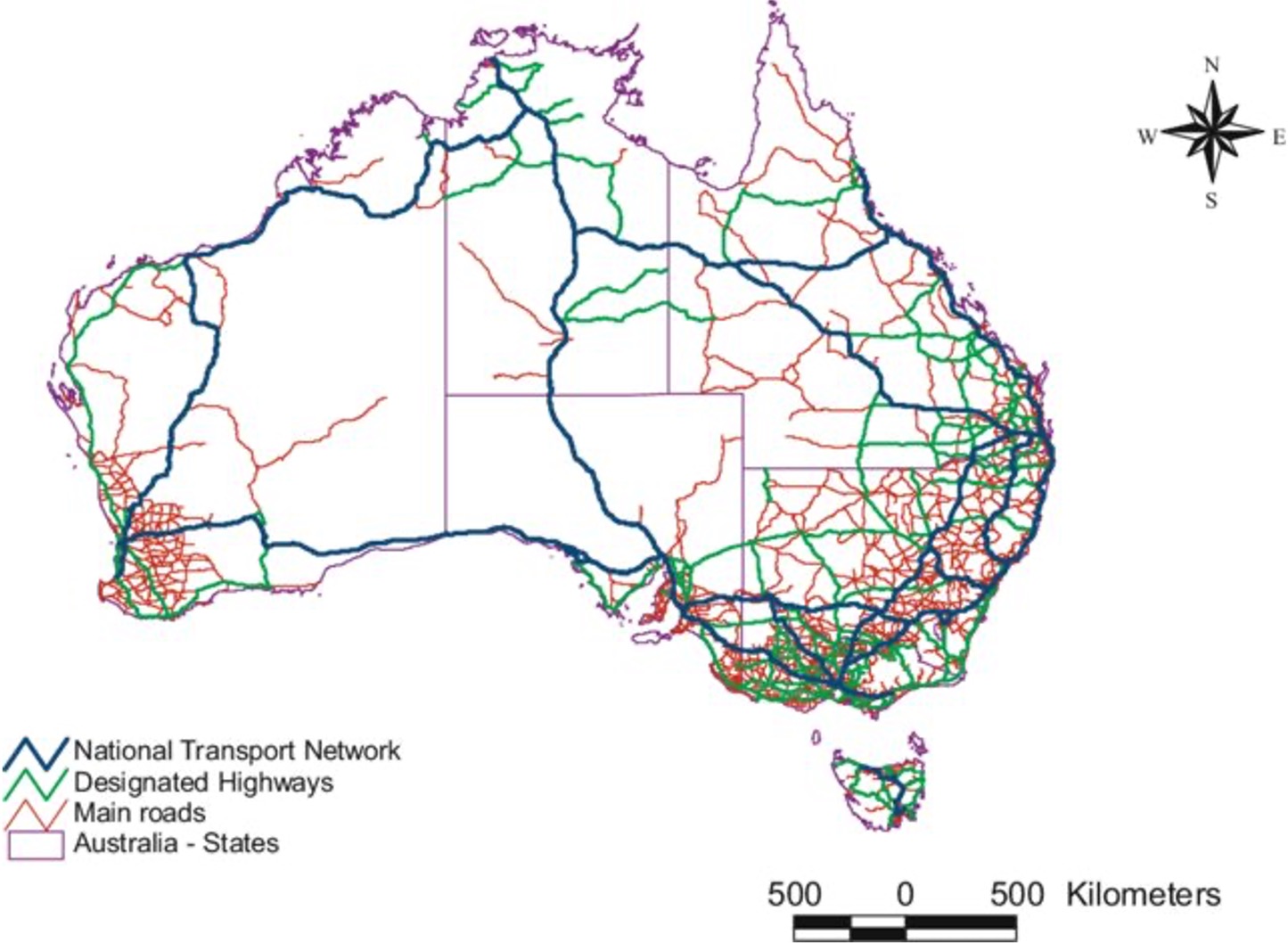
Optimal spread control of Australian forest pests (MSc or PhD projects)

map of Australia's forests

A map of Australia's major forest types (DAFF 2018)

map of Australia's major roads

A map of Australia's major roads from Taylor et al. (2006) Networks and Spatial Economics

I’ve worked on several large-scale models of invasive species spread, but have only worked on species specific management optimisations. Since I have an interest in uncovering generalities in invasions at large scales, I’m interested in seeing whether there could be general spatial patterns in optimal management across species that can be used in situations with poor data or novel invaders. Are the same types of management actions always selected with the same spatial arrangement? Are there rough pest population densities at which the best management action changes? Do pest species traits predict the style of management that is chosen?

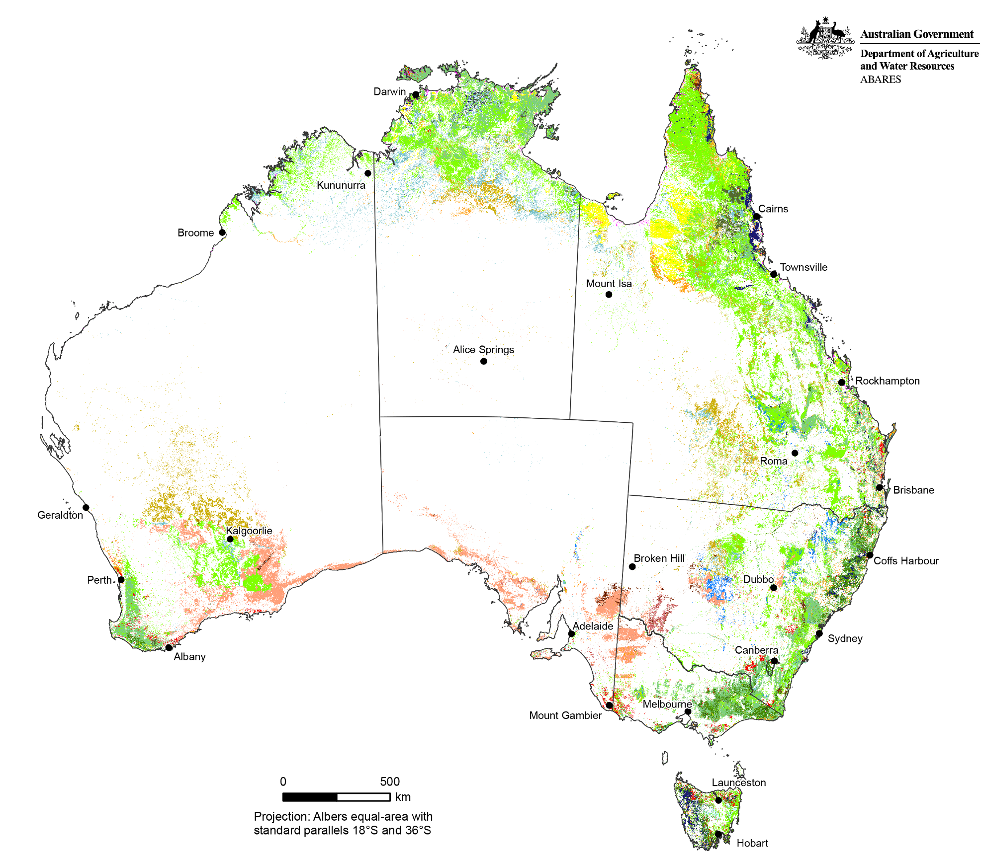
I’m interested in extending my previous invasive species spread, impact, and management optimisations to Australian pest species such as Myrtle Rust and Phythophthora Dieback to understand how a suite of spatial management actions may be optimized to slow their spread. This expansion will require an understanding of Australian transport networks, major vectors of Australian pest and pathogen spread, and host distributional data sources. It will also require partners with practical knowledge of jurisdictional considerations for the different types of pest management options in Australia.